2 The Earth Beneath our Feet: Geology and Landscape
Seldom do we realise that the world is practically no thicker to us than the print of our footsteps on the path. Upon that surface we walk and act our comedy of life, and what is beneath is nothing to us. But it is out from that under-world, from the dead and the unknown, from the cold moist ground, that these green blades have sprung.
Richard Jefferies “Out of doors in February”
Chalk
The Parish of Prestwood is underlain by chalk laid down beneath shallow seas of late Cretaceous times nearly a hundred million years ago (the age of the dinosaurs). This chalk is largely made up of minute plates of calcium carbonate, known as coccoliths, which once formed the external “skeletons” of simple algae. They sank to the bottom of the ocean as the algae died, building up over many millennia to the massive beds of rock we now know. This chalk appears at the surface, however, only where valleys have since cut through the district in geologically recent times. On the hilltops the chalk is covered by clays deposited in the early Pleistocene two million years ago.
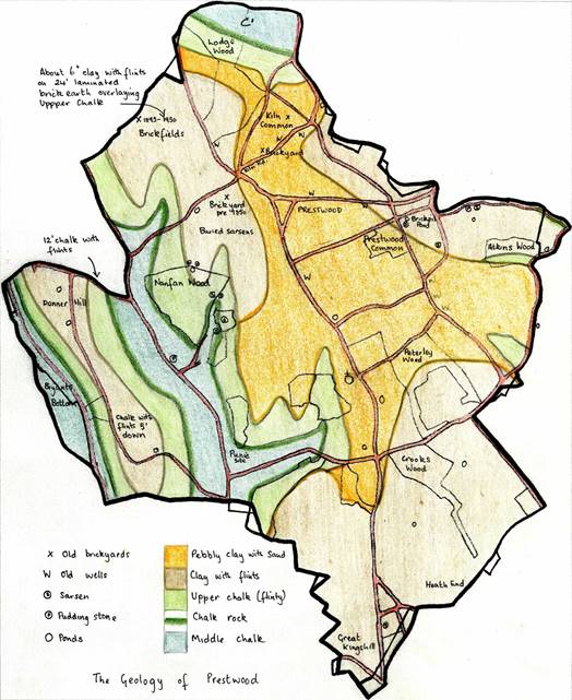
Map of geological strata
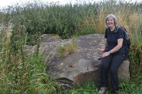
The Middle Chalk is the oldest rock to reach the surface, at the bottom of the valleys (Bryants Bottom, Hampden Road, and the northern tip of the parish). It is a relatively hard chalk with few fossils or flints, about 60 metres thick.
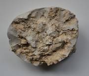
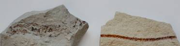
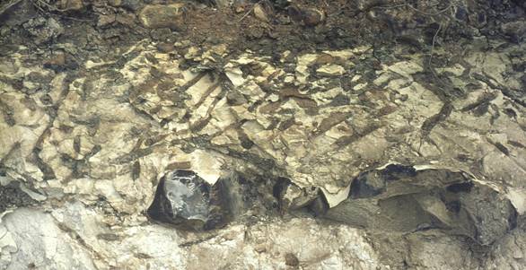
Above the Middle Chalk lies a narrow hard creamy band of Chalk Rock, only a few metres thick, separating the Middle Chalk from the later Upper Chalk. The Chalk Rock was once visible in the chalk-pit in Stonygreen Wood. This band is sometimes called the “Planus” zone, after the typical sea urchin fossils found at this level, a species known as Sternotaxis plana. (See Owen 1987.) It is compact enough, like limestone, to use as building stone. It was particularly excavated by farmers to use for the floors of cattle-sheds because it was porous enough to drain but hard-wearing.
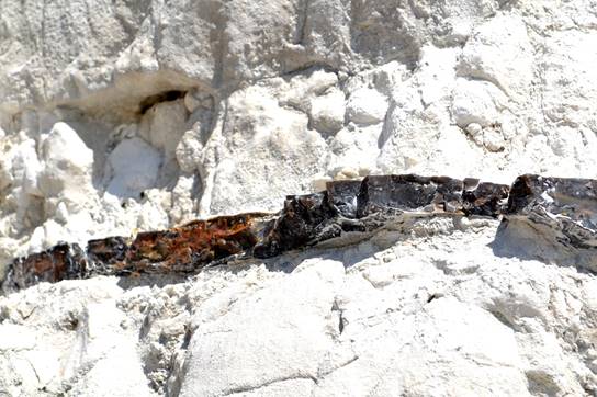
Massive band of flint in chalk similar to that found in association with the chalk rock
|
|
|
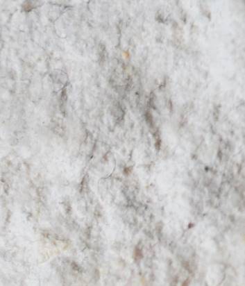
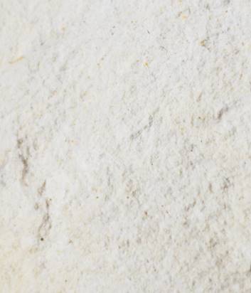
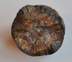
Close-ups, at equal magnification and in same light conditions, of fresh fractures of (left) upper chalk (right) chalk rock, showing the more granular, looser structure of the former
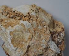
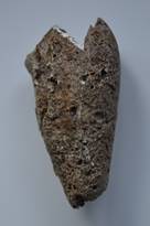
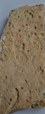
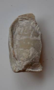
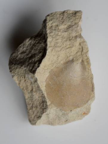
The Upper Chalk would originally have been some 100 metres thick but was mostly weathered away when it formed the land surface, long before the clays were deposited above it. It is now quite shallow (just four metres by Rolls Lane, for instance, according to the Memoirs of the British Geological Survey), and differs from the older chalk in being softer and full of flints. It contains some fossils, especially of sea-urchins, sponges and molluscs. (In other chalk areas of Britain, particularly to the south of London, where the sea was shallower than it was in the Chilterns, the remains of pterosaurs, ichthyosaurs and giant reptiles have occasionally been found.) The flints themselves were formed from an algal “jelly” that surrounded decaying life-forms, especially sponges, when they sank to the bottom of the sea. The jelly hardened and the original soft organisms entirely disappeared, leaving hollows in the flint-stones as a trace of what had been.
Hollow flint formed around a globular sponge, possibly Siphonia koenigi
Flint in essentially quartz in a massive state, but sometimes cavities occurred in the gel when it was solidifying and in such cavities can sometimes be found crystals of quartz.
Flint with cavities in which bands of quartz crystals have formed
Other forms of quartz are chalcedony and agate, and these also occur occasionally in flints, as in the massive flint boulder in the picture below, where small patches of banding typical of agate can be seen.
Massive flint from chalk rock on Denner Hill, partly formed as chalcedony (coloured reddish by iron impurities)
The chalks provide fertile soils for agriculture, but the abundance of flints from the Upper Chalk makes working them difficult. The upper valley-sides, rather steep for agriculture, are often devoted to woodland (Nanfan, Stonygreen, Meadsgarden and Longfield Woods, and parts of Lodge Wood, Lawrence Grove Wood and Atkins Wood). The woodland here today is dominated by beech – “ in the Chiltern country no wood is more familiar ” (as William Coles observed as long ago as 1657), along with much hornbeam, maple, wayfaring tree, buckthorn, ash and wild cherry. The ground flora once included green hellebore, moschatel, wood barley, spurge laurel and others now rare in the parish. The beechwoods supported a local furniture-making industry in the 18th and 19th centuries, when “bodgers” felled the beech and worked it in situ for chair-legs to supply factories in High Wycombe, so that this tree was particularly selected for planting, extending its dominance from the steeper slopes where it was most at home to the clay plateau where oak would once have been at least equally, probably more, common until it got decimated to provide timber for shipbuilding over centuries of English empire-building. Hedgerows in these areas harbour many of the same trees and plants, with maple, holly (which “ with prickly leaves, groweth very plentifully in divers woods and hedgerowes ” Coles 1657), traveller’s joy, cherry and wayfaring tree particularly prominent.
Chalk grasslands in the parish formerly supported a variety of orchids and other interesting calcophilic plants (i.e. those requiring calcium), but these fields have been largely spoiled by neglect or by fertilisation to turn them into grass-dominated pastureland. Nevertheless, it is still possible find clustered bellflower, long-stalked cranesbill, bee orchid, Chiltern gentian, wild basil, basil thyme, hairy violet and others, if one searches in the right places. Where the chalk-rock nears the surface the soils are especially thin and may support a particularly good flora, including rock-rose, wild thyme, and carline thistle. It was on the chalk-rock that man orchid used to grow in the parish, a plant now extinct in the county.
Pits up to five metres deep were dug in the past to excavate chalk, which was burned to form lime for building, powdered to scatter over the fields to increase their fertility, or given to poultry to aid eggshell production. Old overgrown pits can still be seen in many of the fields and woods in the parish. Occasionally nearby clays have lined these pits through solifluction (soil washing downhill), so that they now hold water and form ponds.
Despite its apparent lack of structural strength, the harder chalks like chalk-rock were used at one time for building. Chalk was even used for pillars in the original parish church, but had to be replaced by Bath Stone (a more durable limestone) shortly afterwards when they began to crumble. There was some controversy over this at the time, when the Bucks Herald cited the incident as an “instance of the expensive results of false economy.” (16 December 1848.) The vicar of neighbouring Hughenden Parish, John Pigott, however, responded in a letter to the same newspaper that the problem resulted from the contractor failing to dry and protect the chalk adequately before building, and that chalk “ properly dried, has been largely used in many of the oldest Parish Churches in South Bucks, for outside as well as under work. In Little Marlow Church for example, not only are the massive pillars entirely formed of it, but it is also largely used in the tower, which remains uninjured though it has now been exposed to the tests of some centuries. ” (21 December 1848.) I wonder, however, whether the problem was the use of the softer upper chalk instead of the more durable middle chalk or chalk-rock.
Minerals
Flints provided a plentiful local supply of building material, still to be seen today in the surviving nineteenth century flint cottages characteristic of the area. They would also have been worked in Neolithic times to form stone tools, because of the way the flint fractures with very sharp edges. A flint axe from this time was found in 1970 on the site of the present Junior School in Prestwood. Although cheap and readily available, flint is not as durable as it might appear. It easily sheers and is therefore not very good at bearing a heavy load. It is most suitable for smaller buildings, like farm-workers’ cottages, and then only when supported by a framework of stone or brick. The cumbersome shapes of flint must also have made it difficult for building. Nevertheless, where these cottages and other buildings (such as the Parish Church itself) survive, they are undoubtedly very picturesque. The flints are black (broken surfaces) or white (pristine surfaces) and they can be mixed to form patterns or designs. While black is the commonest colour, quite a few flints are reddish from the presence of iron oxides.
Range of flint types; that at upper right probably formed around a cylindrical sponge
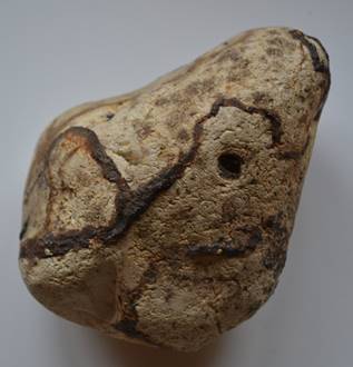
Iron occurs frequently in the chalk, but usually too dispersed to be of any significance. Occasionally nodules of iron ore occur, however, usually in association with flints and in places they were common enough to be mined for smelting iron and making or repairing metal tools. This probably began in the Iron Age and was certainly carried on by the Romans in other parts of the country. There are remains in some of local woods (Piggotts just west of Prestwood parish and Peterley within the parish) of pits where iron ore was extracted and smelted on site using the abundant timber all round them as fuel. Around such pits can be found fragments of iron ore in heaps of refuse and even pieces of metal. The date of these local pits is probably medieval and deposits of iron ore were never enough for this to be more than a cottage industry.
|
Flint pebble with rusted veins of iron ore; such veins, however, would have been unworkable to make iron |
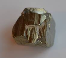
Crystalline form of iron pyrites
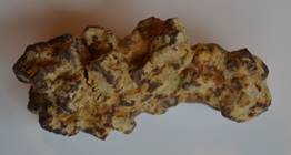
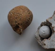
Small nodule of iron ore of the kind that was worked locally |
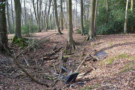
Old iron-ore quarry in Peterley Wood, unfortunately since used for dumping
While the main iron ore in the chalk is iron pyrites, another form, marcasite, can also occur as rounded nodules. When first broken open such nodules display a bright pale yellow lustre but this soon oxidises to a rusty colour and can decay altogether. The typical radiating structure made by the marcasite crystals, however, can survive for some time.
Cross-section of a marcasite nodule from the chalk, decayed but showing radiating structure
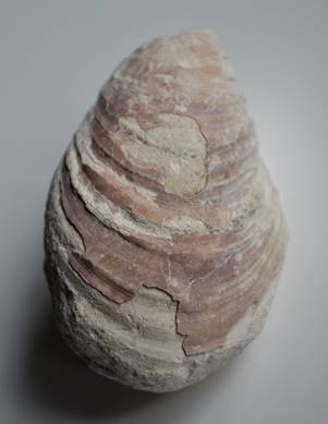
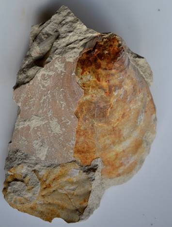
Fossils
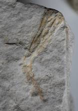
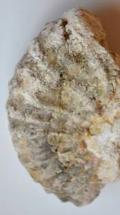
Fossils of sea creatures may be found in the chalk, although for the most part they are not all that common. The main exceptions are the sponges, but these are usually converted into flints which only roughly preserve their overall shape and appearance. Sea-urchins may also be preserved as flints. In the chalk itself brachiopods and molluscs (mostly bivalves, but some ammonites) may be found, often as fragments. In some cases the shell itself may even be preserved, although this is very fragile in the fossil state, but more often just the impressions of these creatures in the chalk matrix are all that can be found. The following plates show a few found locally, based on typical specimens, often fragments, rather than the rare perfect ones that are very unlikely to be discovered. Some of the identifications are therefore tentative. (LC Lower Chalk, MC Middle Chalk, UC Upper Chalk, CR Chalk Rock.)
(1) Sponges
Sponges are soft-bodied but their tissues include mineralised spicules that help build a sort of skeleton and it is these which are fossilised.
|
Podosphaera globularis (UC), like small marbles
Siphonia koenigi (UC) typically as here an external cast inside a flint nodule; pear-shaped to round with a short stem
Cross-section near base of Siphonia koenigi still showing septa |
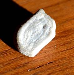
Cliona cretacea (CR-UC)Tiny spheres found in large colonies in flints
Ventriculites choroides (MC-UC) Trumpet-shaped, ribbed; this specimen is just a cast
Pachinion scriptum (UC) cylindrical, tapering at base - here with the long top part broken off |
Cliona cretacea - flint with many tiny impressions, the cast of the sponge itself having been lost, although one survives near the centre of this photo
Pachinion scriptum (see left) - part of lower stem |


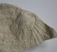
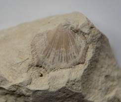
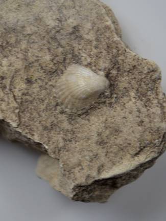
(2) Brachiopods
Early shelled creatures , somewhat like bivalve molluscs, very common in the Cretaceous era, but rare in modern seas (where they are known as lamp-shells).
|
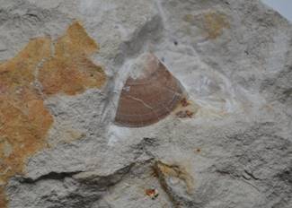
Gibbithyris merensis (CR) oval, smooth |
Orbirhynchia wiesti (MC) almost round with many radiating ribs |
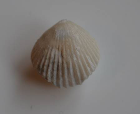
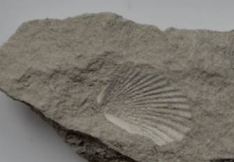
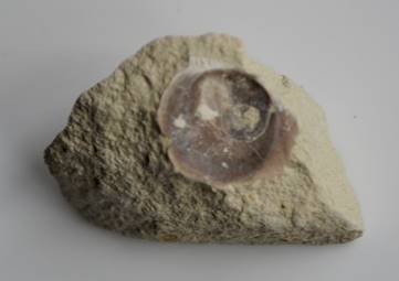
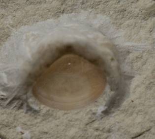
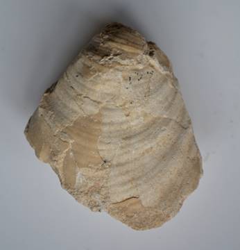
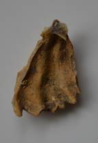
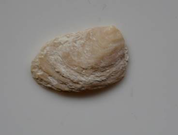
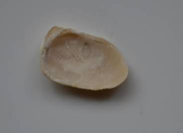
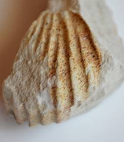
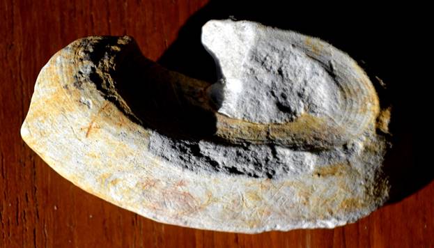
(3) Molluscs: Bivalves
These were also common in the Cretaceous, just like today, much more so than the gastropods.
|
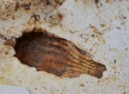
Hypoxytoma tenuicostata (UC)
Mimachlamys cretosa (MC-UC) common |
Neithea quinquecostata (LC-UC) common
Spondylus latus (LC-UC) |
|
Plicatula inflata (LC)
Fragment of Plagiostoma hoperi (CR-UC) smooth, flattish with faint reticulation
Inoceramus pictus (LC) |
Atreta nilssoni (LC-UC) small, usually attached to other shells
Plagiostoma globosum (LC) smooth, somewhat inflated, with faint reticulation
Mytiloides labiatus (MC) |
|
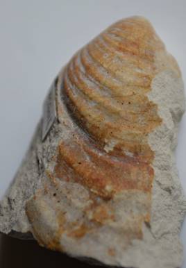
Cremnoceramus inconstans (UC) Part of shell intact. Fragment of an ammonite intruding bottom left
Volviceramus involutus (UC) |
Sphenoceramus patootensis (UC) common
Tiny fragment of Cladoceramus undulatoplicatus (UC) shell is very corrugated
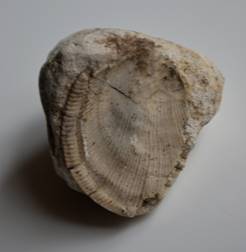
Adult & juvenile specimens of Pycnodonte vesiculare (LC-UC) common |
|
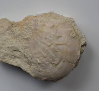
Rhynchostreon obliquatum (LC) Above: exterior of shell Below: interior of shell, with muscle scars still visible
|
Beguina turoniensis (CR) |
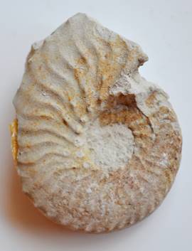
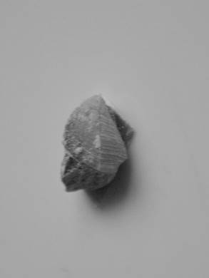
(4) Molluscs: Ammonites
Ammonites were still quite frequent in the Cretaceous until the Lower Chalk, but declined soon after. They are distinguished by the manner of coiling, type of margin and the shape of the transverse ribs.
|
Hyphoplites falcatus (LC) Flat disc with sickle-shaped ribs |
Hyphoplites falcatus showing borings in the shell by some creature after it died - whether worm, sponge or molluscs is not known. Note also remains of a bivalve mollusc impressed on it. |
|
Schloenbachia varians forma subtuberculata (LC) fragment Strong ribs, each with two tubercles.
Calycoceras gentoni (LC) fragment Broad rounded whorls & prominent ribs
Calycoceras guerangii (LC) fragment Large ammonite with broad coarse ribs |
Mantilliceras saxbii (LC) fragment Rounded ribs, no tubercles. Convolute markings at top show part of the complex internal structure
Calycoceras asiaticum (LC) Each ribe has two widely-spaced tubercles not clearly visible in this worn fragment
Mariella dorsetensis (LC) A late development in the ammonites comprised spiral whorls forming a turreted shell like gastropods. This is half of one whorl. |
(5) Molluscs: Gastropods
These snail-like molluscs are not at all common in the chalk
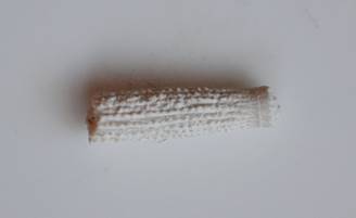
Turritella dibleyi (LC). Single whorl of a tall spired shell, showing the characteristic fine grooves
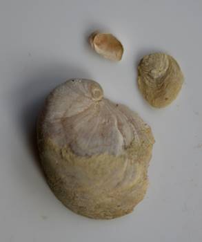
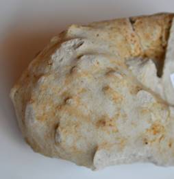
(6) Sea-urchins
These are quite common in the chalk, especially in the Chalk Rock and Upper Chalk, usually converted to flint casts, but sometimes well-preserved. They are identified using shape, the placement of the sutures marked by the holes where spines were attached, and the placement of the mouth and anus on the underside. Some of them had elaborate strong spines that are themselves preserved separately. All have the penta-radial symmetry of the echinoderms, shared with starfish and sea-lilies.
|
Spine of Cidaris species, straight with ridges of prickles
Fragment of the test ('shell') of the sea-urchin Glerotremites rotundus (LC) showing the sockets where spines were attached |
Cast in flint of spine of Tylocidaris clavigera (CR-UC), club-shaped, rounded with ridges of prickles
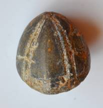
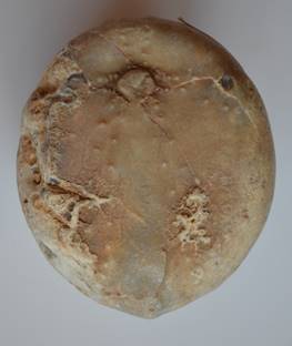
Conulus albogalerus (CR-UC) Tall conical shape |
|
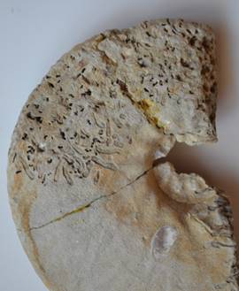
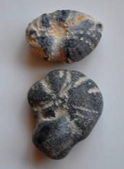
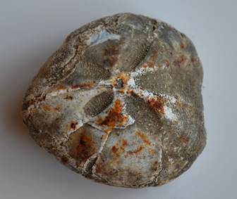
Sternotaxis plana (CR) This is the defining fossil of the chalk rock, which is also known as the S. plana zone. The lower specimen above has a lump of flint obscuring the regular five-fold shape. The specimen on the right is a cast in flint which shows fine details of the sutural structures and spine attachments. The flint has filled the sea-urchin, so that this is a cast of the inner surface of the test.
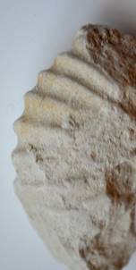
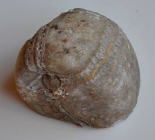
Echinocorys scutata (MC) Conical body. This oblique view shows the sides and the underside with the mouth (centre) and anus (bottom)
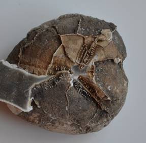
Micraster cortestudinarium (CR-UC) Round heart-shaped body. Mouth on the anterior edge to the right. The flint gel before setting has leaked out through the cracked test to the left. |
Echinocorys scutata . Another specimen viewed from below, with mouth at top and anus just visible at the extreme lower edge.
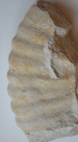
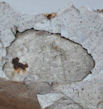
Micraster coranguinum (UC) Another heart-shaped urchin. This specimen clearly shows the keeled posterior at left. |
(7) Other orders
|
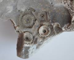
Barnacle Cretiscalpellum glabrum showing the small triangular plates with transverse lines. Height 1cm. |
"Heads" (thecae) of crinoids or sea-lilies Bourgueticrinus fritillus. Height 1cm. Their tall stems are almost always found disarticulated.
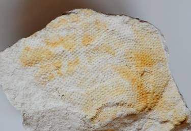
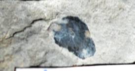
Bryozoan (sea-mat) 'Membranipora' sp . Encrusting colony in chalk. |
(8) Fish remains
|
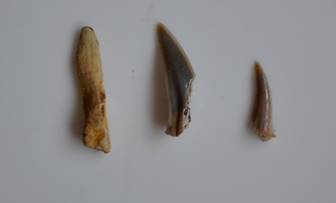
Shark teeth
Cycloid fish-scale. Length 5mm. |
Fish tooth. Note concentric oval structure. Length 9mm.
Worm-tracks in chalk marked by fragments of fish-scales, the worms having been feeding on fish remains. Width of tracks 5mm, 1mm. |
Post-Cretaceous deposits - the Clays
Around sixty million years ago the chalk was overlain by Eocene deposits, sands and clays of estuarine and river origin, but in Prestwood they have been entirely eroded away since they were uplifted to form dry land. (These deposits can be seen in other areas, some not so far away, such as the Reading Beds at Northmoor Hill or Harefield Great Pit: see Eyers, 1998.)
Fossilised borings in the chalk made in Eocene times by worms (Terebella harefieldensis) living in the soil above (from Harefield Great Pit, Hertfordshire, their type locality where they are abundant)
Snow and ice at the beginning of the ice-age two million years ago fragmented the remains of these Eocene deposits, the upper layers of the Upper Chalk, and the loamy soils derived from both, mixing them into a new deposit of “Clay-with-flints”. This now surrounds Prestwood village, underlies Great Kingshill and Peterley in the south of the parish, and caps Denner Hill to the west, where it is less than two metres thick. The Prestwood plateau itself is a variant of the Clay-with-flints, of similar origin, but containing flint pebbles (rounded by Eocene rivers from the angular flints of the chalk), reddish clay and patches of pale sand. This is known prosaically as the “Pebbly Clay and Sand”. (For more detail see Sherlock 1960.)
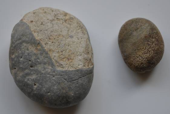
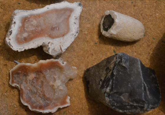
Flint pebbles derived from chalk and polished by rivers in Eocene times, found in the Pebbly Clay and Sand
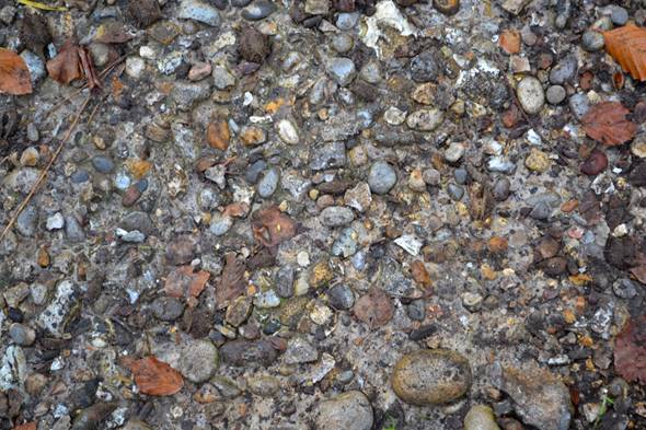
Sandy clay and pebbles in path - note rounded flints and pale sandy clay matrix
The Clay-with-flints, with its greater proportion of chalk rubble, is more calcareous and fertile than the Pebbly Clay. Much of the land on the Clay-with-flints therefore became farmland in medieval times, while the Pebbly Clay was predominantly associated with heathy commons, largely built over in recent decades of housing expansion (except for a few small areas reserved as recreation grounds or allotments). Flints from the clays are less fissile and sharp-edged than those fresh from the chalk, and were used in the past as road-metal and for building (see above).
The clay-with-flint soils are only moderately good for cultivation, tending to be cold and getting temporarily water-logged and then compacting hard on drying. A moderately stony (10% flints) dark grey-brown silty clay loam topsoil overlies silty clays containing up to 30% flints, gleying between 40 and 50cm depth (in places at only 30cm) to become poorly draining, this being the primary limitation to the productivity of the land. Below about 80cm the soils are generally impenetrable from the concentration of flints. The poorer soils will support cereal crops but are generally used to grow grass for pasture. The better soils are used for cereal and some less demanding crops such as beet, potatoes and rape.
The clays also supported woodlands, where oak was joined by beech, cherry and hornbeam with a sprinkling of whitebeam, birch, rowan and holly. These woods, which have mostly survived from ancient times, have an interesting ground flora including woodruff, yellow archangel, wood spurge, wood speedwell, bluebell, woodrushes, wood melick, wood millet and yellow pimpernel, together with the pinks of foxglove and rosebay in the clearings. The bluebells were sufficiently abundant to attract a tourist trade out from London in the early 20th century to collect bundles of the flowers, along with sprays of fresh green beech leaves. Fruit-trees also grew well on the clays and Prestwood was once blessed with a considerable number of orchards, especially of cherry, plum, greengage, and damson. Few of these orchards survive apart from individual trees incorporated into gardens, although wild bird-sown descendants are often encountered in the hedgerows today.
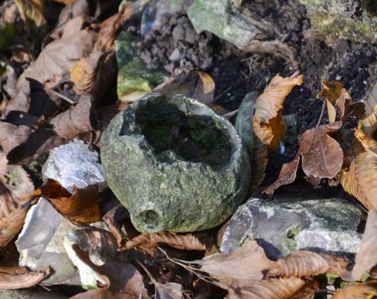
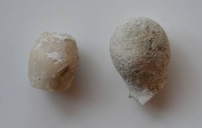
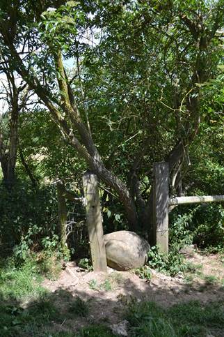
The former Eocene beds contained huge scattered boulders of hard white quartz sandstone (quartz arenite) probably formed by the cementing together of pockets of sand grains by lime in the percolating water. These “sarsens” (also known as greywethers) survived the general erosion of these beds and were incorporated into the more modern clays. These boulders, identical to those used to build Avebury Stone Circle and Stonehenge in prehistoric times, are still discovered today when digging new foundations for building. Samples have been excavated and left at various places throughout the parish. Others may simply have been left exposed by the weathering of the soft clays around them and are regularly turned up by the plough, being discarded at a number of field-edges. According to Gardner (1999) farmers called them “growing stones”, “because no matter how much they removed more surfaced in their fields” just like the flints.
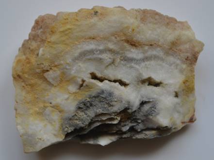
Denner Hill stone
Sarsens from various parts of Prestwood were worked in the nineteenth century as a source of durable paving stones. Particularly productive were the clays of Denner Hill, where sarsens (locally termed Denner Hill Stone) were found anywhere from two to twenty metres deep by workers probing with long T-shaped skewers called “snipers”. Experience enabled these men to distinguish between flint and sarsen by the sensation of scraping the skewers against the subterranean rock. The blocks, which could weigh as much as 350 tons, were split using iron bands, wedges and “28 inch hammers” into square flat sections called “setts”. These can still be seen where they were laid at Windsor Castle, in the centres of Aylesbury, High Wycombe (the Guildhall, Market House, All Saints Church and the Abbey), Great Missenden (foundations of St Peter and St Paul), Great Hampden (foundations of St Mary Magdalene), Bradenham (church quoins) and elsewhere. Corners of flint cottages were often protected by using the same stone, and chippings from the working of the boulders were used as road-metal. The splitting of the sarsens created a fine dust that affected workers’ lungs - much like silicosis among coal miners - so that, despite the use of wattled hurdles to deflect the dust, frequent changes of workforce were necessary. Five years was considered a long career in stone-cutting. (See Druce 1926; Massingham 1940; Gardner 1999.) The extraction of stone on Denner Hill was begun as early as medieval times.
Grotto at Missenden Abbey built from Denner Hill stones at base, with ceiling of puddingstone
Former weir in River Misbourne, Abbey Park, constructed of blocks of Denner Hill stone (partly obscured by fallen tree)
They also made good querns for grinding corn, and were often used as track or boundary markers, a practice that probably dates back, appropriately, to the Stone Age. Sarsens can still be seen today at strategic corners of woods or where tracks enter fields, although many of these probably represent no more than that such heavy stones removed from an arable field would naturally be left at the closest place possible, that is at the boundary, and once placed they would be difficult to move.
Denner Hill stone marking corner of a field (Church Farm, Hughenden)
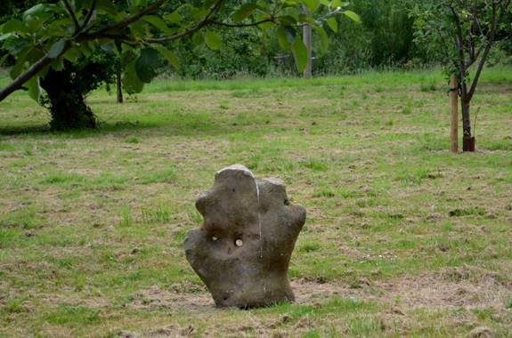
Denner Hill stone used as decoration in Andlow's orchard
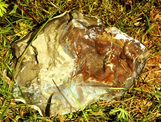
There are also blocks of “puddingstone” derived from the cementing together of round flint pebbles and sand in Eocene river beds, excavated from time to time from the clays, like the sarsens, although less frequently. These attractive stones, which when split show a striking pattern of dark discs in a pale sandy matrix, are also to be seen lying in various places in the parish (e.g. opposite Andlows Farm).
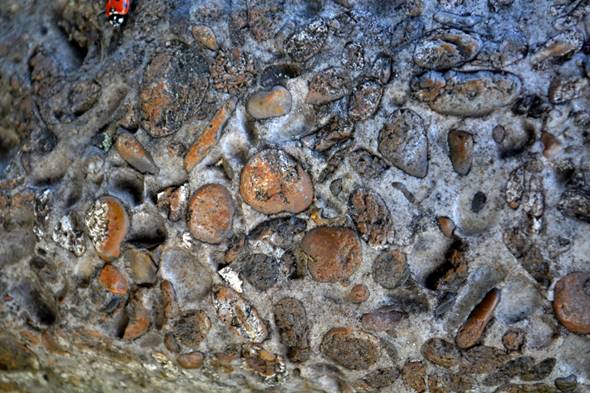
Puddingstone. Comparison with the picture above of "sandy clay and pebbles" you can see how this puddingstone could have been derived from consolidation of the clay
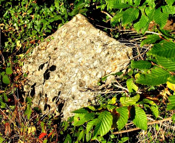
Puddingstone in hedge by Andlow's Farm (photo Val Marshall)
Brick-earth
In some places on the clays, sandy or silty “alluvial” deposits formed in relatively recent times where there were lakes or rivers. These reddish derived clays are known as “brick-earth” and were worked until recently for making bricks, tiles and drainpipes. Brickfields existed at various sites in Prestwood since at least the mid-17th century (when both Tibballs and Delafield were local firms), particularly expanding in the 19th century. The last firm ceased operation in the early 1950s.
Pike (1980) describes the original brick-making process:
Traditionally, the clay was dug during the winter to enable it to be broken down by frost. Brickmaking would then begin in the late spring and continue through to the autumn … The weathered clay was puddled either by workers treading it or in a pug-mill, a barrel-like structure containing a series of blades. The resulting soft, paste-like clay was then put into a mould – a rectangular, wooden box frame. The moulds were then placed on wooden racks inside “drying hacks”, wooden tent-shaped structures, which allowed the bricks to be “cured” or to dry out before firing. Bricks were formerly fired in clamps in the open air; they were stacked on edge over a fire of charcoal or turf and the pile covered by underfired bricks from a previous firing in order that the heat could be retained. The heat would be gradually increased to allow the bricks to dry out slowly. After three days, the fire would be allowed to go out, although the bricks inside the clamp or kiln would take ten days or so to cool down sufficiently to be removed.
In larger brickyards these clamps were eventually replaced by permanent kilns of rectangular or, later, circular shape, and many other improvements in the quality of the process were made over time (Hammond 2001). It was not until the middle of the C19th that bricks were shaped with hollowed tops (“frogs”) to assist with retaining the mortar and reducing their weight.
The first records of brickmaking in Prestwood are entries in the Great Hampden Parish Register from the mid-1600s onwards referring to Tibballs [Theobalds] of Prestwood, brickmakers, and they certainly supplied bricks to Hampden House in the 17th and 18th centuries. Their brickyard was at Kiln Common and the Tibballs' house at one corner was known as Kiln House (originally Kill House, using an old version of "kiln"). Thomas Tibballs lived here in the 16th century and it was his grandson James who supplied bricks to Hampden House 1683. The will of John Tibballs (1604) dated 1669 (he died 1671) also mentions a plot of land (Town Meadow) near Martin's End which includes the present Brickpits Pond, so that this would seem to have been the site of clay-digging for the Tibballs brickyard. In the mid-17th century John Tibballs had "Michaelmas" (not the original name) Farm built as the main family home, south of Kiln Common, while a junior branch of the family remained at Kiln House.
A second brickyard at Kiln Common also had a house with garden, and orchard, attached, known as Kiln Cottage. It was started before 1720, when it was owned by John Warren and leased to the brickmaker David Haws. It was bought by William Cordwell of Penn in 1721, by Hannah Tibballs in 1749, by John Matthie in 1825, and by Thomas Mullett in 1865. Brickmakers here over that period included Gregory Axten and his daughter Agnes (1731; Gregory was the son-in-law of William Cordwell), Joshua Davis of Chesham (1748; the husband of Gregory Axten's daughter Rebecca), and William Ayres (1825). [These dates of occupancy are those confirmed by documents, the actual periods will have included several years before or after these.]
Another early brickyard was at Nanfans, started by Thomas Avery and inherited by his son William, who later took over the Kiln Common site from the Tibballs around 1825. The Nanfans site then fell into disuse. The remains of a clay-pit can still be seen by the side of the footpath from Nanfan Wood to Nanfans Grange.
In the 1870s there were still two brickyards in the Kiln Common area, a small one with a single kiln belonging to Elisha Essex, and the original one now run by William Avery, subsequently operated by Solomon Groom, who also burned lime. The Zion Baptist chapel in the graveyard by Kiln Road, where Solomon lies buried, was partly built from his own bricks. Neither of these brickyards survived long into the C20th and their sites are now entirely covered with residential housing.
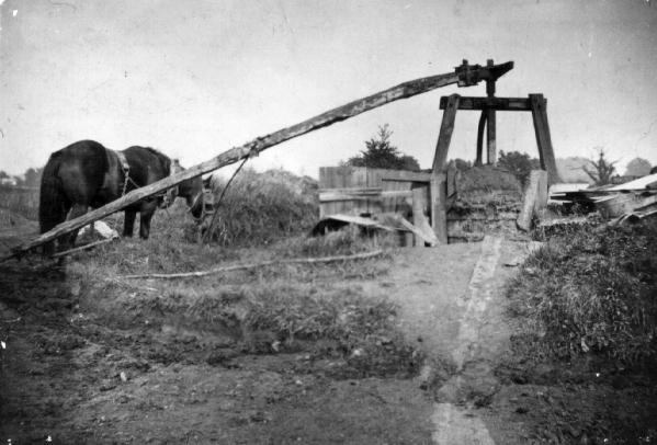
Horse-operated pug-mill at Howard's brickyard
The largest brickyard in Prestwood was started in 1895 by Samuel Howard. It was situated in the north-west corner of the parish, the brickearth there being about 8 metres thick beneath a cap of clay-with-flints of about 2 metres depth (Memoirs of the British Geological Survey). According to the information in Pike (1980) Howard had seven kilns and employed 80 men at peak periods in 1939. It made higher quality bricks than the previous yards, including specialist ones (e.g. to match old buildings). According to Samuel’s daughter-in-law Edith, the clay was dug out by hand and brought up from the bottom of the pits in horse-drawn trucks. She adds that various ingredients were added to the clay during puddling; for instance, coal dust left black marks in the bricks after firing, while flint made white flecks. The brickfields were closed during the Second World War “ because the glow from the kilns would have helped enemy planes to locate Chequers (the Prime Minister’s country residence) and Naphill (where the air force was situated). ” They were used during that time for storing government vehicles, and re-opened by Samuel’s son William in 1949. They lasted less than a decade, however, before being closed for good. The pug-mill and kilns have gone, the site having been used since as a rubbish dump. Prestwood Sports Centre and its playing-fields were built on the southern part. The rest of the site off Honor End Lane, north of the Sports Centre, is still visible as a large area of disturbed ground, on part of which was constructed a now-disused stock-car racing track, and where clay-pigeon shoots were held until recently. A footpath passes right through it. While the brickworks may have long gone, the bricks survive all over Britain. According to Edith again “ The Howard bricks were used for the Royal Masonic Schools at Rickmansworth and Watford, Merchant Taylors school at Moor Park, Bournemouth High School for Girls, Cambridge University libraries, Norwich Town Hall, Lady Margaret School, Oxford, Prestwood village hall in 1928 and the shafts of the Mersey Tunnel. ” (Howard 2000.)
Natural Water Resources
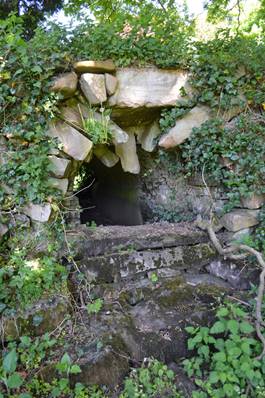
While most of the chalk beneath Prestwood is capped by clay, it is also sealed far below the surface by an ancient impervious layer of Gault Clays, thus effectively sealing in water that collects in the chalk to provide a natural reservoir. It is possible to bore down through the surface clays to reach the saturated layers of chalk. In former centuries some cottages and farms constructed their own wells in this way and some of these wells still survive, although none are in use today, filled in or securely covered to prevent accidents from people falling in (which unfortunately did occur occasionally). There were wells built at various times in the Kiln Road, High Street, Nairdwood Lane and Sixty Acres Road areas, but the deepest were behind Peterley Manor, including one of 172 feet (over 50 metres) and another, the deepest well in Buckinghamshire, of 250 feet (80 metres)! These must have been prodigious undertakings and they demonstrate the depth of the water-table here – after all Prestwood is on a hill and the chalk reservoir found natural outlets further below, as at Mobwell, 56 metres lower than Peterley Manor. That they went to all this trouble indicated the value of access to pure water at the time.
Other cottages in Victorian times and later employed another means of obtaining water, by run-off after rainstorms, directed to ponds (for watering stock) or to large underground tanks beside habitations – these could be 5 metres across and 3 or 4 metres deep, and thus provided ample storage for times of drought, topped by stones and iron covers to prevent evaporation and pollution. This would not have been as pure as spring or well water, but it was adequate for drinking, especially if boiled. Many of these Victorian tanks survive today and still collect vast amounts of water, sometimes used for watering the garden, even if it is no longer needed for human consumption. They can be seen, for instance, at Denner Farm, Peterley Manor, and Pankridges.
Rain and run-off, often deliberately channelled, also supported many ponds in the region. Recent building, however, has disrupted such supplies and parched the clays so that they crack and are less efficient at holding water, coupled with a long-term failure to maintain their puddled-clay linings, so that most of the ponds are now rapidly evanescent after rains end.
Landscape
The glaciers of the ice-ages, near their southern limits, were deflected by the Chilterns escarpment, so that the Chiltern plateau, where Prestwood lies, is devoid of glacial drift deposits. When the glaciers melted, however, forming lakes bounded by the escarpment, flood waters burst through in places to form the typical “dry valleys” of the Chilterns, the chalk topped with clays being relatively easily eroded. Once the flood waters dispersed, the valleys so formed, not constituting natural river courses, and underlain by permeable chalk, remained permanently dry. They can, however, form temporary water-courses after periods of high rainfall. In early 2002 the water-table rose sufficiently for the Misbourne, normally sourced from Mobwell, just north of Great Missenden, to rise several hundred yards uphill at the edge of a field beside the Missenden-Wendover road. At times in the past (1663, 1764, 1774) similar conditions brought about a stream along the Hampden Bottom road that also ran into the Mobwell spring through Rignall (Keen 2003). The other dry valley in the parish, which separates Denner Hill off to the west and where Hampden Road now runs, was probably once the site of a stream, as the valley’s former name was Wateringdene. The present stream only emerges much lower, south of the parish at Hughenden. Local people like the Davis brothers at Collings Hanger Farm, however, remembered times only decades ago when heavy rain made the Hampden Road into a river.
The characteristic steep-sided valleys formed in this way are a major feature of the topography of the parish. As they run more or less north to south, they make walking from east to west or vice versa a particularly arduous task, whether it is finding the energy to pace upwards on one side or maintaining one’s footing on loose stony or leafy litter of the downward slopes on the other. Another feature that will be obvious to anyone who has cycled the ways across these narrow “bottoms” is that the steepest part of all is just before the crest is reached, a cruel climax for the panting pedaller. The steepest section is where the band of chalk rock runs along the hillside, wearing away more slowly than the neighbouring strata. Most of the lanes up such slopes
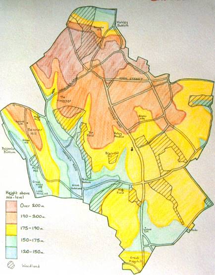
Map Of Contours For Prestwood Parish
regularly turn aside at this junction to climb diagonally and relieve the extreme gradient, creating a typical S-bend. Aside from Hampden Bottom, the dry valley just north of the parish, two other major dry valleys can be readily experienced by driving or walking along Hampden and Bryants Bottom Roads. Another one rises up from Hampden Road along Perks Lane, bends northwards between Blackmoor and Hockey Fields and ends as a shallow depression along the bottom of Prestwood Park, once marked in the early 19th century by the line of a hedge.
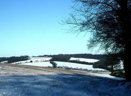
View from edge of Lodge Wood across Rignall Road valley to Cobblershill
The best scenery of the parish is provided by these sudden descents, such as the views from the edge of Denner Hill, from the edges of the woods paralleling the hill on the other side of the valley (Nanfan to Meadsgarden and the Picnic Site), or north from Lodge Wood and Honor End. These are all splendid at any time of year, whether the eye is greeted by the bright green spring verdure, the yellows of the summer crops, the reds of the autumn beechwoods, or the stark brown or icy white of winter, while a fascinating patchwork of fields, woods and hedgerows twist across the rounded contours. The view from Honor End in particular has been honoured by its selection for the site of the John Hampden monument (see next chapter), which stands out, clearly but not too ostentatiously, against the skyline, the hard lines of its stone softened by the surrounding grove of oak and sycamore trees planted at the time it was erected and now in full maturity.
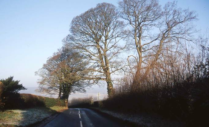
Start of the descent down Honor End Lane, the monument barely visible as a cross in a circle in front of the central tree trunk
The contours of the parish thus follow the geological strata. The highest part of the parish is that area of the clay plateau north of the High Street and across the Brickfields, reaching over 205 metres above sea level at the boundary just south of Honor End. The lowest point is just below 120 metres, well into the lower chalk, where Hampden Road crosses the boundary just south of Denner Hill Lodge. In the compass of this small area, only a few miles across, the height above sea-level in one place may therefore be almost twice that in another. Unsurprisingly, the main roads follow the less steep routes up the longer dry valleys (Bryants Bottom, Hampden Road) or across the clay plateau (e.g. Wycombe Road, High Street). The major settlements - Prestwood and Great Kingshill - are also situated on the plateau, which slopes gently southwards. Only Bryants Bottom occupies a valley, as its name suggests, unless one also includes the houses following Perks Lane, although this is a relatively recent settlement and has no separate community name.
A striking feature that is relatively uncommon in the area is the presence of swallow-holes (dolinas), more characteristic of limestone areas. Underground waterways in the limestone rock gradually erode larger and larger caverns. If this erosion reaches the surface the ceiling collapses and the overlying soil sinks into a large steep-sided depression that can be 20 metres or so across. The softer chalk has fewer such underground caverns, but the same phenomenon may occasionally occur. In woodlands they can at first look like the remains of old quarries until one realises there exists no shallow entrance for a horse and cart to remove materials. A good example is in the northern part of Atkins Wood, and a smaller one can be seen in Piggots Wood. The strange “pond” in Great Kingshill called Cockpit Hole has the contours of a swallow-hole and this may have been its origin, as the depression plunges almost straight down from the level of the surrounding land and roads, so that the water that has accumulated there, presumably from clay “plugging” the chalk cavern, is some 10 metres down.
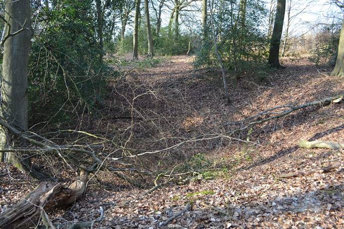
Probable swallow-hole in Atkins Wood
Climate
The climate of Prestwood is influenced by regional factors – in south central England, distant from the coasts – and the generally elevated situation of the Chilterns compared to other parts of the south. Winter temperatures are fairly low, typical of central England, 3-4ºC January mean, while summer ones are quite high, typical of central and southern England, but warmed by proximity to the Thames valley, about 17ºC July mean. Unlike most of the surrounding countryside, however, Prestwood occupies a small patch of higher precipitation (rainfall and snowfall) than the generally dry central to eastern England and Thames Valley, more comparable to the south coast than to the rest of the Chilterns, with over 750mm annually. Like the Chilterns generally, the parish is close enough to the London industrial corridor for sulphur dioxide pollution to be quite high, about 15-16μg S/m³. However, this level of concentration is much less than it was in the middle of the twentieth century.
[The map of surface geology which forms part of the parish map was based on the British Geological Survey geological map (drift edition) one-inch series, sheets 238 and 255. The original surveying for this map was carried out in the 1870s and revised in 1902. The survey was conducted by a number of sample borings and clues from surface features. Many of the boundaries of the drift strata are therefore interpolated from a restricted amount of data and are only approximate. From a closer examination of some of the surface features I am led to conclude that the area of pebbly clay and sand reaches further southwards in the parish than is indicated by the official survey. While Prestwood Park is recorded on chalk by the latter, it in fact appears to be, for perhaps all but the southern end, on the clay. There are also rounded flints characteristic of the pebbly clay to be found as far south as Crooks Wood, not stopping at the southern boundary of the main section of Peterley Wood as currently shown. The true boundary here should probably be up to half a kilometre further south-east.]